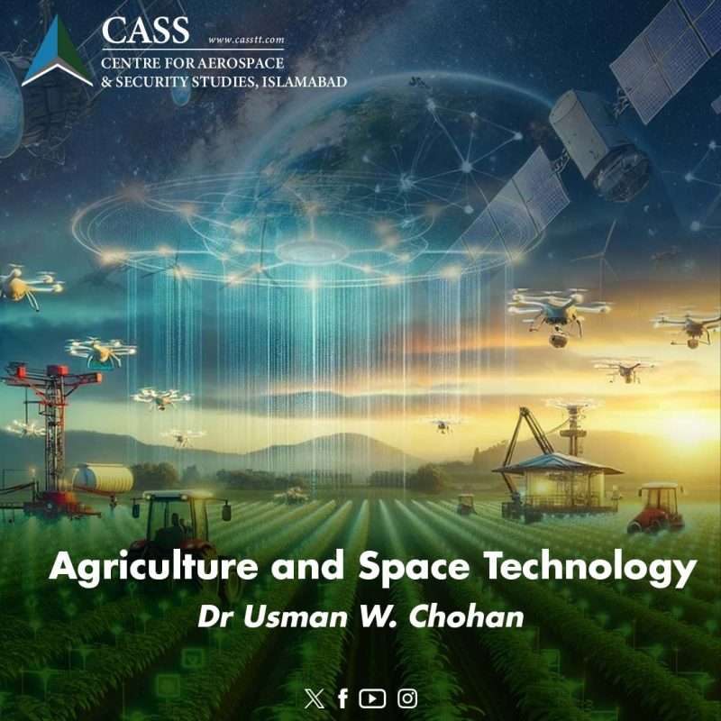
Pakistan is often described as an agrarian society, with nearly 40% of its labour force, a quarter of its GDP, and 70% of its exports being broadly related to agriculture. Yet Pakistan’s agricultural yields are low and falling, its population is burgeoning, and the sector is soon to get a taxation jolt that was a long time coming. Given the importance of agriculture, along with the challenges that the primary sector faces, how might we ensure food security and bolster the vital economic pillar of agriculture in Pakistan? Economists’ suggestions for agricultural improvement span a litany of recommendations based on a significant body of research, with many components being of a longstanding nature but others involving innovations that are more avant-garde. In the latter category of innovative approaches lies the use of space technology for agricultural purposes.
Space technology in agriculture is perhaps not at the forefront of agri-reform discussions, but there are important ways in which the deployment of space technology can bolster the agricultural sector, including in: precision farming, water management, agricultural taxation, disaster management, storage/logistics, anti-smuggling measures, crop mapping, and anti-encroachment measures. These are all avenues of exploring the ‘space economy’ (space technology in the agri-economy) that would bolster the sector in ways that warrant specific examination.
First, the field of precision farming is one that addresses yield improvements in a direct manner, allowing for targeted interventions that maximise agricultural outputs, lower costs, and promote sustainable actions through robust technology-based action. Precision farming depends on satellite imagery to make useful inferences about agricultural variables such as crop conditions, land usage, crop yields, precipitation, water levels, and fertilizer usage, among others. The most important requirement lies in the interpretation of results provided by satellite imagery to make the appropriate inferences, and once precision farming becomes more widespread in developing countries such as Pakistan, it shall increase the human-scientific capital invested in agriculture for it to be treated as an even more specialised science. Precision farming is thus the most obvious area of scientific engagement that deploys space technology towards more optimal agricultural outcomes.
Second, the riverine and alluvial nature of agricultural hydrology in Pakistan (along its five major hydro-fluvial waterways) means that water management is extremely important. The point is underscored by a rising population that is presenting competing demands for water-intensive uses, as well as the significant glacial melt and altered monsoon patterns both resulting from climate change and wreaking havoc on the country’s hydrology. In that regard, satellites have multiple uses in assisting with water management, above all by monitoring water levels (and water storage) across land use areas, riverine and alluvial flow (along with water body segmentation), water stress levels, and monitoring rainwater harvesting efforts. In addition, the glacial melt, new lakes, and overall glacial conditions are also a prime use for satellite imagery (for example in the Eastern Hindu Kush region) where the altered formations for water systems require keen attention. As such, the sensitive riverine and glacial hydrology of Pakistan can be monitored in far better ways through the use of space technology, with significant benefits to water management for agricultural uses in the country.
Third, the agricultural sector is soon to receive a significant taxation jolt, given the current IMF programme’s stipulations for including such a significant economic sector into the fiscal broadening efforts that characterise the current programme. Yet taxation can be done at various levels of efficiency, where efficiency itself is one of the elements of an ideal taxation system. The most efficient approach would be one of segmenting agricultural tax brackets according to parameters such as size, usage, intensity, and yields. In doing so, one would find fewer chances of blanket measures that create unfairness (another element among the tax ideals) for various types of agricultural participants (e.g. small landholders, staple producers etc.). Space technology can give a far clearer picture of the parameters in question, through which the tax authorities could reap more optimal taxation levels that respect both fairness and efficiency, making Pakistan’s ongoing economic reforms more sustainable going forward.
Fourth, it is tragic to note that many types of natural disasters have left the agricultural sector atrophied and its participants left to suffer, ranging from locusts swarms to the iconic floods, and much in between. In the field of disaster management, satellite imagery has long played a very important role, because the ‘view from above’ offers flexibility, responsiveness, and precision in disaster mitigation and management practices. Since the agricultural sector is vulnerable to such disasters, it is important to have space technology constantly used (as the National Disaster Management Authority is doing) to build a complete picture that minimises crop damage and overall economic losses, saves lives, and adds efficiencies in limited-resource conditions.
Fifth, there are strong merits in the deployment of space technology to monitor supply chains, logistics, and storage elements of the agricultural sector (just as with other sectors such as the blue economy). One of the most pressing problems in agriculture is not just that of production or consumption, but of post-harvest losses during transport and storage. Satellite monitoring of the supply chain for the farm-to-market spectrum can help to identify the major bottlenecks and zones of spoilage for the vast agricultural produce of the country, leading to lower post-harvest losses and greater national food security.
Sixth, space technology has a strong use case in anti-smuggling efforts in the country vis-a-vis the agriculture sector. Due to variety of cross-border economic distortions, including: tax loopholes, racketeering, organised crime, sanctions, law enforcement deficits, and informal economic systems; the smuggling of food staples (i.e. the ‘grey food trade’) across the Pakistan-Afghanistan border is ‘rampant.’ If the political will to stamp out the grey food trade were to exist, then inflation in Pakistan would be far less of a problem (given the size of food in the inflation consumer basket). To implement such will, satellite imagery can provide a far clearer picture of both the magnitude and direction of such cross-border movements and thus aid law enforcement in their actions.
Seventh, and for the longer-term, space technology can help with policy planning and resource allocation, in terms of the promotion of specific crops (subsidy compliance), deterring encroachment on prime agricultural land, and the misuse of agricultural land, among other such land use issues. To deploy space technology for such purposes would mean that Pakistan could translate policy initiatives in the agricultural sector into more tangible results, thus transforming the basis of the agri-economy into one where better resource allocation is possible and more optimal land use is achieved.
As such, agriculture’s importance to the economy makes it a key area where technological improvements can have a significant positive effect. Space technology can help modernise and improve food security and the agri-economy in low-cost ways by enabling optimisation through oversight. Although space technology may be considered one of the more avant-garde areas of agricultural reform, and there are many longstanding policy solutions on the table as well, our purpose must be one of strengthening the primary sector of the economy in a manner that ensures nutritional security, sustainability, and progress. Space technology cannot be ignored in that regard.
Dr Usman W. Chohan is Advisor (Economic Affairs and National Development) at the Centre for Aerospace & Security Studies, Islamabad, Pakistan. He can be reached at [email protected].


